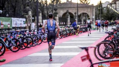


We analyze the cycling sector of the Iberian Triathlon Championship LD and MD Iberman 2017
{wbamp-meta name=”image” url=”/images/stories/noticias/analisis-circuito-cyclista-iberman-2017.JPG” width=”300″ height=”150″}
The organizer of the test has made a detailed analysis of the cycling sector
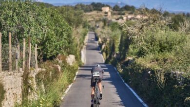
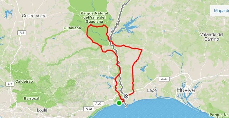
You can already see the entire route of the bicycle sector of Iberman LD and MD Iberian Championship The next 21 will be held in October with departure and arrival in Vila Real de Sto Antonio (Portugal).
They will be 167,4 Km with 2.175 meters of difference. The spectacularity and variety of the route will make you forget the moments of hardness. It will be the same as in 2014 and 2015, in those two editions, lthe fastest in this sector were the Portuguese Joao Pedro Olivara in 2014 with a time of 5h 24 minutes and the Spanishl Iker Baztarrika who used a final chronometer of 5h 1 minute at an average of 33 km / h.
We will leave Monte Gordo Beach towards Vila Real de Santo Antonio, to which the first classified will return after 9 hours of competition. Those first 3 km are comfortable to adapt to the position. From km 3 to 4,9 we will have to be careful because we pass through an avenue next to the river, but by ADOQUINES. Be careful because this km does not save time and you can lose a lot ..
Then we return to a good road that will guide us to Castro Marín (Km 8) after crossing the Estero de Carrasqueira and the Do Sapal Nature Reserve of Castro Marín. From there, once we pass under the highway that joins Seville and Faro, the A-49 in Spain and the A22 in Portugal, we will reach Monte Francisco (km 11,6), always by the EN-122. The next district will be JUNQUEIRA (Km, 14.9), until here we take a difference in 134 m on a good road. In the 18.6 Km we crossed AZINHAL, before, from the 16 to the 18 we will make a couple km of slight rise. At the exit we will start a descent to 21, where we start another small climb up to km23.

At km 20,3 point we come to the junction with Almada de Ouro, but we continue straight until the next junction at km 23,8, which we turn right onto the M-507 towards FONTE DO PENEDO (Km 25.4) AND ALCARIA. In these first 24km we have already accumulated 381m of unevenness. In ALCARIA we enter the 26 Km and begin to descend to the most spectacular part of the route, which we will do bordering the Guadiana River to ALCOUTIM point of return of the MD. Before we will pass through the beautiful villages on the fringe of the river of Fox de Odileite (km 30.4), EL ALAMO (km 33.3).
At km 34 we have a junction to the right to continue bordering the river and continue through small towns that give a color to this part of the route, the first, GUERREIROS DO RIO (km 34,7), then LARANJEIRAS (Km 35,9). At km 38 we go a bit inland, and at km 39 we come across the magnitude of the Guadiana river, which we will not abandon until we arrive at ALCOUTIM at km 44.8. This will be the return point for the Media Distancia participants, who will return to Monte Gordo along the same road to complete the 90 km. Up to this point, the positive slope has been 610 meters without much difficulty. After regaining strength at the Aid Station, we will face the longest climb with just over 3km from 46 to 49, but without large percentages. We are going up the rehabilitated M507 in search again of the main artery that connects Mértola and Vila Real, the N122. In this section we do not pass through any town.
In the 56.6 Km we return to the N122. We turn right to start looking for MÉRTOLA (km 82). They will be 26km in which it will be necessary to go with much caution because not being traffic closed on Portuguese soil, and being a busy road, there will be many cars, although there, the work of the Portuguese Police (GNR) is spectacular, always pending of the cyclists, giving them passage and warning the drivers. In these 26 km we accumulate other 610 meters and already in Mértola we have accumulated a total of 1,203m. Here there will be another refreshment, besides the own one (km 83.1).
After crossing the Rio de Oerias we climb to this historic city where its people turn to the test. We left crossing over the Guadiana River (km 83.4), which we will cross again in the sector of the race from Spain to Portugal. We are at 22 km from Spain. We started the tour of the E265, also in very good condition. In the 87 Km we find two crosses, the first on the right and the second a few meters on the left, but we will continue straight. It is a favorable stretch with small ups and downs. At km 91.8, another crossing, which we will also ignore to continue looking for the new road that will take us to the border, which will be at Km 93.1. Where we should turn to the right. Eye to this point. It can not happen to you. Nor do we go through any locality. The next one that we will find will be the spectacular one of POMARAO, before room of step on Spanish soil.
We will leave behind four crosses (km 96.3, 98.3, 100.2 and 100.7). The road from km 93 is somewhat rougher. To Pomarao we arrived at km 105 after a vertiginous descent of 3km. We will find a new refreshment station to face the last difficulty of the day. In this step to Spain at the height of the Chanza River reservoir we have already accumulated the highest percentage of unevenness, 1.557 meters. The least good has already happened. Now a small climb of 2 km and in the 177,3 km we will arrive at the first town in Spain, EL GRANADO. The road is spectacular an asphalt in perfect condition.
Since we entered Spain, Traffic is closed and controlled by the Civil Guard, but we must always drive on the right and respect the signs in case some clueless falls on the route. After a new Avituallamiento we set sail for VILLANUEVA DE LOS CASTILLEJOS (km.130,6) where we will not enter as we turn right at the first roundabout that we will find, direction SAN SILVESTRE DE GUZMÁN on the A-499.

From here to the T2 in Ayamonte, 37 will be very favorable km as they certify us the almost 2000 meters of altitude that we have already overcome. At km 144 we enter SAN SILVESTRE, where the last refreshment station will be located before the T2. Already always descending to sea level, we crossed the last town before the T2 in Ayamonte, VILLABLANCA (km 154), which always turns over with the passage of the participants. We continue descending to go through the Autovia again, in this case the A-49 (km 160).
One last effort in a small climb up to km. 162, and we will join the N-431 that we will not leave until Ayamontina locality after taking a left turn at km 163. Last 4 km in continuous descent to reach the Parador roundabout (km 167.4), where we turn left to climb 400 meters and finish at C / Brasil de AYAMONTE, place of the T2.
In total, 167 kilometers and 800 meters and 2175 meters of accumulated positive height difference.
There are no previous results.